Frequently Asked Questions
The most-asked questions about nigerian states.
What exactly are 'Nigerian states' in this context?
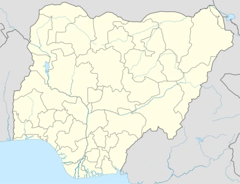
Nigerian states are the 36 administrative divisions that make up the Federal Republic of Nigeria, each with its own elected governor, capital city, and set of local government areas. Together they form the country's primary layer of subnational governance beneath the federal level.
How many states are there and how did the number grow?
There are 36 states in total, starting from just three in 1967 and expanding through reorganization exercises in 1976, 1987, 1991, and finally 1996. The 1996 creation of twelve additional states under President Sani Abacha brought the count to where it stands today.
Who are the key 'characters' or figures tied to the states?
Each state is led by a directly elected governor serving a four-year term, and the collective is overseen by the federal government seated in Abuja. The states are also grouped into six geopolitical zones—North-West, North-Central, North-East, South-West, South-South, and South-East—that shape regional identity and political dynamics.
Where should a newcomer start exploring the 36 states?
A practical entry point is to learn the six geopolitical zones first, then examine individual states by capital city, population, and economic profile. Lagos (most populous) and Borno (largest by area) are commonly cited as contrasting anchors for understanding the range.
How does Abuja fit in, and why is it not counted as a state?
Abuja sits within the Federal Capital Territory (FCT), a separate administrative unit that is not one of the 36 states. It was designated the national capital in 1991 to relieve Lagos of its dual role as both commercial hub and seat of government.
What are the most notable 'milestone moments' in the states' history?
The 1967 creation of the original three states is the foundational event, followed by the 1976 jump to 19 states and the 1996 expansion to 36. The 1991 relocation of the capital from Lagos to Abuja is another widely discussed turning point that reshaped the political map.
Which state is the largest and which is the smallest?
Borno State in the North-East holds the largest land area, while Lagos is the smallest by a wide margin. This contrast also highlights a stark density difference, with Lagos packing over 15 million residents into a compact coastal footprint.
How are the states governed on a day-to-day basis?
Each state operates with an executive headed by the governor, a unicameral state house of assembly, and a state judiciary, mirroring the federal structure at a smaller scale. Governors may serve at most two consecutive four-year terms before being required to step down.
What makes this collection of 36 states distinct from other countries' subdivisions?
The boundaries were shaped by decades of negotiation over ethnic, religious, and geographic representation, making them a direct reflection of Nigeria's complex social history. The 1996 batch of twelve new states remains one of the most politically charged reorganizations in the country's post-independence era.
Can a state secede or have its borders redrawn?
Under the Nigerian Constitution, no state may unilaterally secede, and any boundary change requires a constitutional amendment passed by a two-thirds majority in both chambers of the National Assembly. In practice, no state borders have been altered since the 1996 reorganization.