Adamawa State
A state formed from the historic Adamawa Emirate, with Yola as its capital.

via Wikipedia: Adamawa State · see source
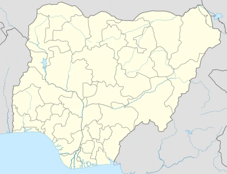
Adamawa is a state in the North-East geopolitical zone of Nigeria, bordered by Borno to the northwest, Gombe to the west, and Taraba to the southwest while its eastern border forms part of the national border with Cameroon. It takes its name from the historic emirate of Adamawa, with the emirate's old capital of Yola serving as the capital city of Adamawa State. The state was formed in 1991 when the former Gongola State was broken up into Adamawa and Taraba states. The state is one of the most heterogeneous in Nigeria, having over 100 indigenous ethnic groups.
- Major Religions
- Sunni Muslim, Christian, and traditional ethnic religions
Verified Timeline
Lore & Background
Before it became a state in Nigeria, Adamawa was a subordinate kingdom of the Sultanate of Sokoto, which also included much of northern Cameroon. The rulers bear the title of emir ("lamido" in the local language, Fulfulde). The name "Adamawa" came from the founder of the kingdom, Modibo Adama, a regional leader of the Fulani Jihad organized by Usman dan Fodio of Sokoto in 1804. Modibo Adama came from the region of Gurin (now just a small village) and in 1806, received a green flag for leading the jihad in his native country. In the following years, Adama conquered many lands and tribes. In 1838, he moved his capital to Ribadu, and in 1839, to Joboliwo. In 1841, he founded Yola, where he died in 1848. After the European colonization (first by Germany and then by Britain), the rulers remained as emirs and the line of succession has continued to the present day. In the early 1800s, the Fulani jihad seized much of modern-day Adamawa State and formed the Adamawa Emirate under the Sokoto Caliphate. About 90 years later, forces from Germany and the British Empire defeated the Emirate in the Adamawa Wars and split the area. The British-controlled area (much of the west of modern-day Adamawa) was incorporated into the Northern Nigeria Protectorate which later merged into British Nigeria before becoming independent as Nigeria in 1960. The German-controlled area formed a part of German Kamerun until allied forces invaded and occupied Kamerun during the Kamerun campaign of World War I. After the war, what is now eastern Adamawa State became most of the Northern Cameroons within the British Cameroons until 1961, when a referendum led to a merger with Nigeria. Originally, modern-day Adamawa State was a part of the post-independence Northern Region until 1967 when the area became part of the North-Eastern State. After the North-Eastern State was split in 1976, Gongola State was formed on 3 February 1976 alongside ten other states. Fifteen years after statehood, Gongola was split with the state's south becoming Taraba State while its north became Adamawa State.
Reader's Guide
Adamawa State has been badly impacted by the Boko Haram insurgency. In January 2012, Boko Haram attacked Gombi, Mubi and Yola. By 2014, the state became home to camps housing an estimated 35,000 internally displaced people, fleeing violence from Boko Haram in locations including Mubi, Madagali, Askira Uba, Bama and Gwoza in the states of Adamawa, Borno, and Yobe. In 2014, an estimate placed the number of IDPs around Yola at 400,000. An attack occurred in Chakawa in 2014. A suicide bombing in Yola in 2015 killed over 30 people. A double suicide bombing in Madagali in 2016 killed over 50 people. Mubi is the worst affected place in Adamawa State, suffering major attacks in 2012, 2014, 2017 and 2018. On 21–22 February 2020, Boko Haram terrorists launched an attack on homes and churches in Garkida, killing three soldiers and wounding civilians. As an agriculturally-based state, the Adamawa State economy mainly relies on livestock and crops, such as cotton, groundnuts, millet, cassava, guinea corn, and yams. The Dangote group operates a sugar production factory in Numan which has a sugar refining capacity of 3,000 tonnes of cane per day. The state has around 1.5 million cattle and 64 grazing reserves of which 30 are gazetted. Geographically, the state is mainly composed of highlands and mountains (the Atlantika, Mandara, and the Shebshi ranges) and the Adamawa Plateau crossed by valleys and rivers, most notably the Benue and Gongola rivers. In the extreme south of the state is part of the Gashaka Gumti National Park, a large wildlife park that contains large populations of bushbuck, African buffalo, patas monkey, black-and-white colobus, giant pangolin, and hippopotamus along with some of Nigeria's last remaining Nigeria-Cameroon chimpanzee, African leopard, and African golden cat populations.
Did You Know?
- Adamawa is the eighth largest state in Nigeria by area, but the thirteenth least populous with an estimated population of about 4.25 million as of 2016.
- The state has over 100 indigenous ethnic groups, including the Verre, Bwatiye (Bachama), Kamwe, Mumuye, and Fulani.
- About 50% of the population is Sunni Muslim, 40% is Christian (mainly Lutheran, EYN, ECWA, and Pentecostal), and 10% are adherents of traditional ethnic religions.
- A measles outbreak was reported in an internally displaced persons camp in Adamawa State in January 2015.
- Flooding in October 2022 claimed 37 lives and submerged 89,000 hectares of farmlands in the state.
The Adamawa Emirate & Historical Foundations
The story of Adamawa begins with Modibo Adama, a regional Fulani leader who, in 1804, became part of the jihad organized by Usman dan Fodio of Sokoto. In 1806, Adama received a green flag to lead the campaign in his native region of Gurin. Over the following years he conquered numerous lands and tribes, building a kingdom that would carry his name. He relocated his capital several times — to Ribadu in 1838, then Joboliwo in 1839 — before founding Yola in 1841, where he died in 1848. The emirate functioned as a subordinate kingdom under the Sultanate of Sokoto, with its rulers holding the title of emir, or lamido in Fulfulde. European colonization first brought German and then British control, yet the emir line of succession endured and persists to this day. The territory was divided between British and German spheres; the German-controlled eastern portion became part of Northern Cameroons until a 1961 referendum merged it into Nigeria.
A Landscape of Mountains, Rivers, and Wildlife
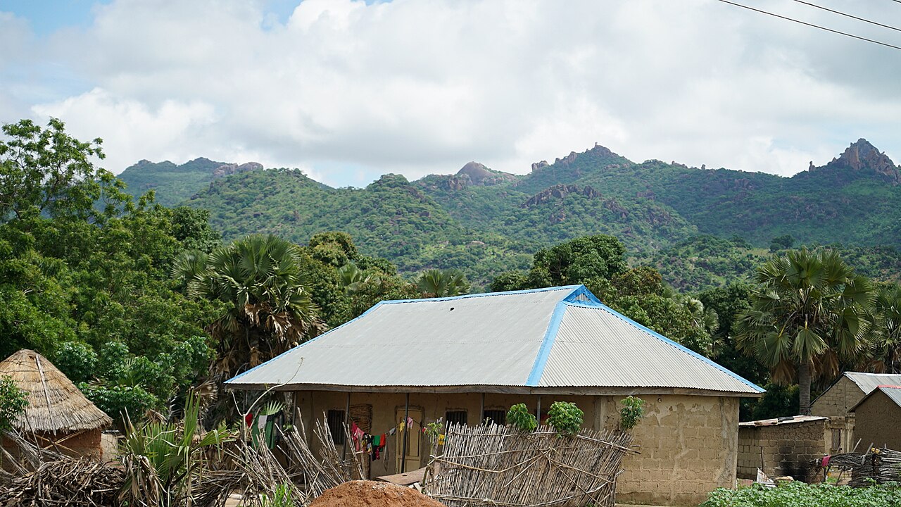
Adamawa State spans roughly 36,917 square kilometres, ranking as the eighth largest state in Nigeria. Its topography is defined by highlands and mountain ranges — the Atlantika, Mandara, and Shebshi — together with the broad Adamawa Plateau, all intersected by major river valleys including the Benue, Gongola, and Yedsarem. Lowland areas in the north belong to the West Sudanian savanna, while portions of the south fall within the wetter Guinean forest-savanna mosaic. Elevated zones are part of the Mandara Plateau mosaic and Cameroonian Highlands forests ecoregions. In the extreme south, a section of the Gashaka Gumti National Park shelters extraordinary biodiversity: large populations of bushbuck, African buffalo, patas monkey, black-and-white colobus, giant pangolin, and hippopotamus, alongside some of Nigeria's last remaining Nigeria-Cameroon chimpanzees, African leopards, and African golden cats.
A Mosaic of Peoples and Faiths
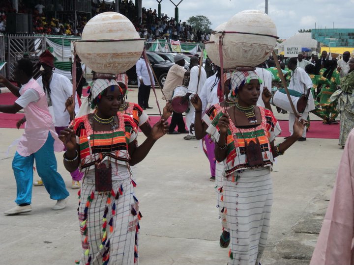
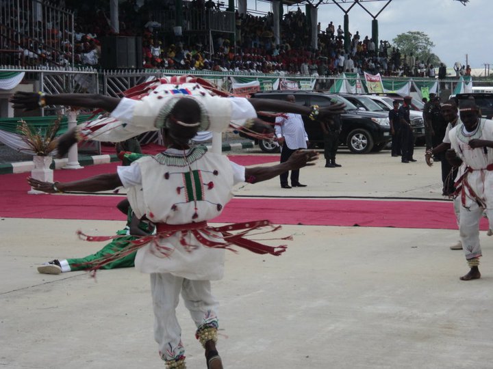
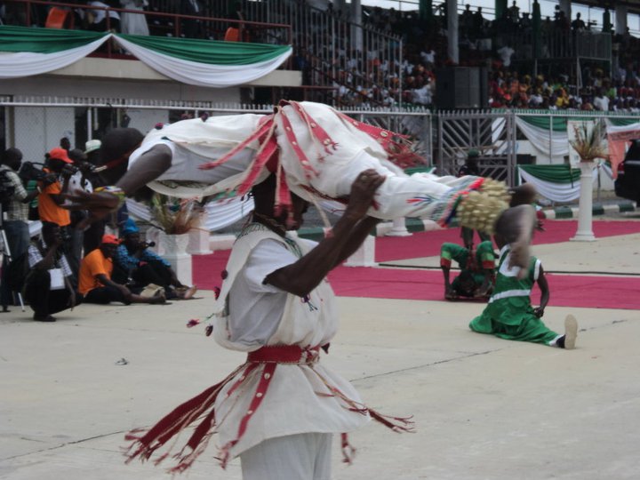
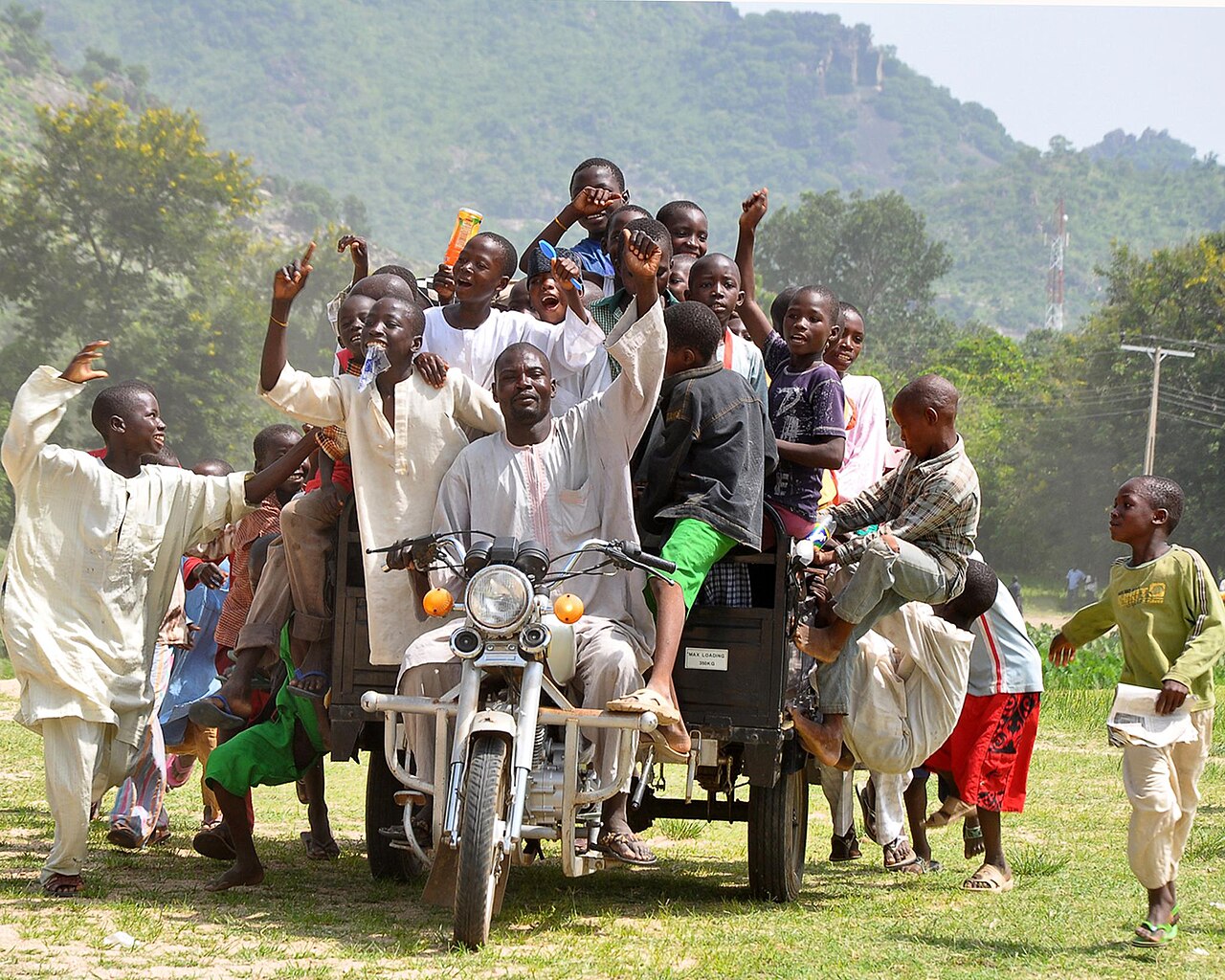
Adamawa is among the most ethnically heterogeneous states in Nigeria, home to more than 100 indigenous groups. The central region has long been inhabited by the Verre, Tsobo, Bwatiye (Bachama), Bali, Bata (Gbwata), Gudu, Mbula-Bwazza, and Nungurab (Lunguda) peoples. The Kamwe occupy the north and central areas, the Jibu reside in the far south, the Kilba, Mafa, Marghi, and Waga are found in the north, and the Mumuye in the south. Fulani communities are scattered throughout the state, many maintaining a nomadic herding lifestyle. Religious life is equally varied: approximately half the population identifies as Sunni Muslim, roughly 40 percent as Christian — with Lutheran, EYN, ECWA, and Pentecostal traditions prominent — and the remaining 10 percent practice traditional ethnic religions. This extraordinary diversity of language, culture, and belief makes Adamawa a living testament to centuries of migration, settlement, and coexistence across the plateau.
The Boko Haram Crisis and the Path to Recovery
The Boko Haram insurgency dealt devastating blows to Adamawa State. In January 2012, attacks struck Gombi, Mubi, and Yola, and by 2014 the state hosted camps for an estimated 35,000 internally displaced people fleeing violence from Mubi, Madagali, Askira Uba, Bama, and Gwoza. Around Yola alone, an estimated 400,000 IDPs had gathered. A 2015 suicide bombing in Yola killed over 30, and a double suicide bombing in Madagali in 2016 claimed more than 50 lives. Mubi bore the heaviest burden, suffering major attacks in 2012, 2014, 2017, and 2018. Even in February 2020, terrorists struck homes and churches in Garkida, killing three soldiers. Despite this, the insurgency has abated since 2016 due to internal terrorist infighting, and development efforts have resumed. Local organizations like the Adamawa Peace Initiative and the Adamawa Muslim Council, along with humanitarian support from USAID, have worked to rebuild communities and restore stability.
Gallery
Frequently Asked Questions
Who is Adamawa State?
Adamawa State is a North-East Nigerian state whose identity is rooted in the historic Adamawa Emirate, with Yola—once the emirate's seat—now acting as its capital. It was carved out of the former Gongola State during Nigeria's 1991 state reorganization.
What are Adamawa State's powers/role?
The state's defining strength is its staggering ethnic diversity, sheltering over 100 indigenous groups alongside Sunni Muslim, Christian, and traditional faith communities. This makes it one of Nigeria's most heterogeneous states and gives it a unique cultural-mosaic role within the North-East geopolitical zone.
How does Adamawa State's story end?
There is no fixed ending in the canon; Adamawa State remains an ongoing, unresolved narrative shaped by the Boko Haram insurgency that has deeply scarred its communities. Its story is still being written as residents rebuild, resist, and reclaim daily life.
Why is Adamawa State important?
It serves as a living bridge between the centuries-old emirate system and modern Nigerian governance while embodying the extreme ethnic pluralism of the North-East. Its 1991 creation from Gongola State also makes it a key case study in how Nigeria's administrative reshaping redefined regional identity.
Where does Adamawa State come from?
Adamawa State was formed in 1991 when the former Gongola State was split into two, drawing its name and cultural heritage from the historic Adamawa Emirate. The emirate's old capital, Yola, was designated as the new state's administrative seat.
More in Nigerian States 1-24
Elsewhere in the Nigerian States universe
Spotted an error? Know more?
This is a living reference — every entry is fact-audited, and reader corrections feed straight into our audit queue. Suggest an edit · See this site's audit record