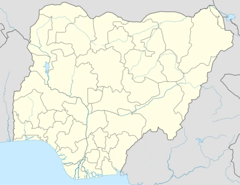
Ondo State
Southwestern Nigerian state created in 1976, capital Akure.

via Wikipedia: Ondo State · see source
Ondo State is a state in southwestern Nigeria, created on 3 February 1976 from the former Western State. Nicknamed the 'Sunshine State', it is predominantly Yoruba and is the 18th most populated state in the country, as well as the 25th-largest by landmass. Its capital is Akure, the former capital of the ancient Akure Kingdom. The state includes mangrove-swamp forest near the Bight of Benin and is home to the Idanre inselberg hills, the highest geographical point in the western half of Nigeria at over 1,000 metres (3,300 ft) in elevation.
- Created
- 3 February 1976
- Capital
- Akure
- Population rank
- 18th most populated in Nigeria
- Landmass rank
- 25th-largest state by landmass
- Nickname
- Sunshine State
- Highest point
- Idanre inselberg hills, over 1,000 metres (3,300 ft) in elevation
Verified Timeline
Lore & Background
Ondo State was formed on 3 February 1976 from the former Western State. It borders Ekiti State to the north, Kogi State to the northeast for 45 km, Edo State to the east, Delta State to the southeast for 36 km, Ogun State to the southwest for 179 km, Osun State to the northwest for 77 km, and the Atlantic Ocean to the south. The state includes mangrove-swamp forest near the Bight of Benin. The Idanre inselberg hills, the highest geographical point in the western half of Nigeria at over 1,000 metres (3,300 ft) in elevation, are located within the state. The ethnic composition consists largely of Yoruba subgroups of the Idanre, Akoko, Akure, Ikale, Ilaje, Ondo, Ese Odo, Owo and Ose peoples, with Ijaw people such as the Apoi and Arogbo inhabiting the southeastern swamps. The vast majority of the population are Christians; minorities practice Islam and traditional Yoruba animist religion.
Reader's Guide
Ondo State's economy relies on cocoa production, farming, asphalt mining, and activities related to its extensive coastline. The state is home to several tertiary institutions, including the Federal University of Technology Akure, Ondo State University of Science and Technology Okitipupa, University of Medical Sciences Ondo, and Adekunle Ajasin University Akungba Akoko. The state government is led by a democratically elected governor; as of 2024, Lucky Aiyedatiwa is the incumbent governor, sworn in on 27 December 2023 as the successor of Oluwarotimi Odunayo Akeredolu who was pronounced dead on 27 December 2023 out of cancer complications. The state contains eighteen local government areas, with major ones including Akoko, Akure, Okitipupa, Ondo, Ilaje, Idanre, and Owo. The majority of the population are Christians; minorities practice Islam and traditional Yoruba animist religion. The Anglican Province of Ondo includes the Dioceses of Akoko (2008) led by Bishop Jacob O.B. Bada (2019), Akure led by Bishop Simeon Borokini (2013), also Archbishop of Ondo Province (2022), and others. The Catholic Diocese of Ondo (1943) has 174,148 Catholics (2021) in 60 parishes under Bishop Jude Ayodeji Arogundade (2010).
Did You Know?
- Ondo State was created on 3 February 1976 from the former Western State.
- The Idanre inselberg hills are the highest geographical point in the western half of Nigeria at over 1,000 metres (3,300 ft) in elevation.
- Lucky Aiyedatiwa was sworn in as governor on 27 December 2023 following the death of Oluwarotimi Odunayo Akeredolu from cancer complications.
- The state contains 18 local government areas, with major ones including Akoko, Akure, Okitipupa, Ondo, Ilaje, Idanre, and Owo.
- The Catholic Diocese of Ondo reported 174,148 Catholics in 2021 across 60 parishes.
Frequently Asked Questions
What is Ondo State?
Ondo is a southwestern Nigerian state carved out of the former Western State on 3 February 1976. It sits squarely in the Yoruba heartland and is best known by its cheerful nickname, the 'Sunshine State.'
What is Ondo State's capital and what's its history?
The state capital is Akure, a city that predates modern Nigeria as the seat of the ancient Akure Kingdom. It transitioned from a royal centre to the administrative heart of the newly created state in 1976.
How does Ondo State rank in size and population among Nigerian states?
Ondo is the 18th most populated state in the country yet only the 25th-largest by land area, meaning it packs a lot of people into a relatively compact footprint.
What is the highest point in Ondo State?
The Idanre inselberg hills dominate the state's skyline, climbing to over 1,000 metres (3,300 ft) above sea level and offering some of the most dramatic terrain in southwestern Nigeria.
Why is Ondo State called the 'Sunshine State'?
The nickname reflects the state's consistently warm, bright climate in the southwestern region. Fans and locals use it as a shorthand for Ondo's identity in the broader Nigerian states community.
More in Nigerian States 1-24
Related in Nigerian States
Links follow this subject's own source article.
Elsewhere in the Nigerian States universe
Spotted an error? Know more?
This is a living reference — every entry is fact-audited, and reader corrections feed straight into our audit queue. Suggest an edit · See this site's audit record